
While ArcGIS is a useful tool that many people rely on to make high quality maps it can be almost as frustrating to use as it is useful. When you open the program you will probably notice that it is slow to start. This slow operating speed remains constant and the program occasionally freezes and crashes. Because of its proneness to crashing it is extremely important to frequently save your work. It seems that the more data you are trying to work with, the slower ArcGIS will run.

The interface of ArcGIS looks and feels as though it has not been updated since it was first released. Whether this is intentional on the part of the developers, following the adage of “if it ain’t broke, don’t fix it”, or an unintentional lack of innovation, the program feels very dated to use. It is a complicated program to use, so it is understandable the developers would be reluctant to change things for fear of having experienced users needing to relearn things. However, I feel the program has not aged well, being left in the past as technology has advanced leaps and bounds since ArcGIS was initially released.
In most cases you are going to have to download data from somewhere that you will work with in ArcGIS. Finding data that works with ArcGIS online is not always a straight forward process but if you have a link that makes things easier. Once you find the data you want to work with you must go through a process of preparing the data for use.
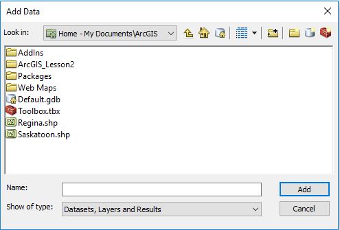
You will need to connect folders and add data to the map. While it sounds like it should be a simple process there are several steps to it which only means there are more opportunities for mistakes to be made. Part of the process of preparing your data before you can work with it is joining the data to different map layers. Once you have successfully gone through this process then you can begin to represent your data in a map.
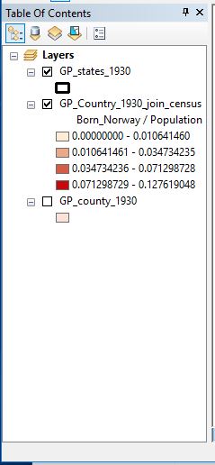
In the table of contents the order of the map layers is an important detail that users must remember to pay attention to. When the “list by drawing order” option is selected you can freely rearrange the map layers. However if any of the other options are selected you will be unable to rearrange the map layers in the table of contents. Although this is a relatively simple issues to fix should you run into it, the solution may not be immediately obvious to a less experienced ArcGIS user. There are countless other issues in ArcGIS with quick and simple solutions that might not be immediately obvious to less experienced users. This can lead to a frustrating experience when trying to get the hang of using the program.
Probably one of the most straightforward tasks you can do in ArcGIS is adding the finishing touches to your map. Giving your map a title, table of contents, and scale bar are all important components of a finished map. The hard part about making a complete map is getting to this final stage.
When it comes to less experienced users needing to produce a high quality map, ArcGIS is a necessary evil. Despite being incredibly not user friendly, ArcGIS dominates the world of mapping software. It is an incredibly useful program but it has a serious flaw in that it is very difficult to learn how to use. It can be a very useful tool for historians to use but without knowing how to use it, ArcGIS’s usefulness to historians is limited.
Good overview of some of the limits of ArcMap. ESRI is in the process of replacing this software with ArcGIS Pro to address these and other issues. On the other hand, the software with all of its issues allowed you to create a competent visualization of the Norwegian born population in about an hour. So while it takes some focus to get through the idiosyncratic nature of the software, I don’t know if it is “incredibly not user friendly”. I’ve never managed to figure out hot make a basic map using GRASS GIS software, which was 50 times more difficult to figure out. I should also mention ArcMap works a lot better on higher quality computers, so part of your frustration comes down to the low quality lab computers.